Monday, October 8, 2018
Windy, snowy, cloudy
We sailed (by motor) all night and made it to the northwest corner of Spitsbergen (another name for the archipelago of Svalbard). Mary Ellen and I both woke up between 1:30-2:30am when the ship was probably at its rockiest. I’ve never sailed on the open seas, so this felt exciting even though we were not too far out from land. Our jackets hung on pegs at the foot of our beds swung lazily from side to side. The ship rounded the northwestern corner, and we awoke in the Nordvestøyane island group to gray wind and sideways snow.
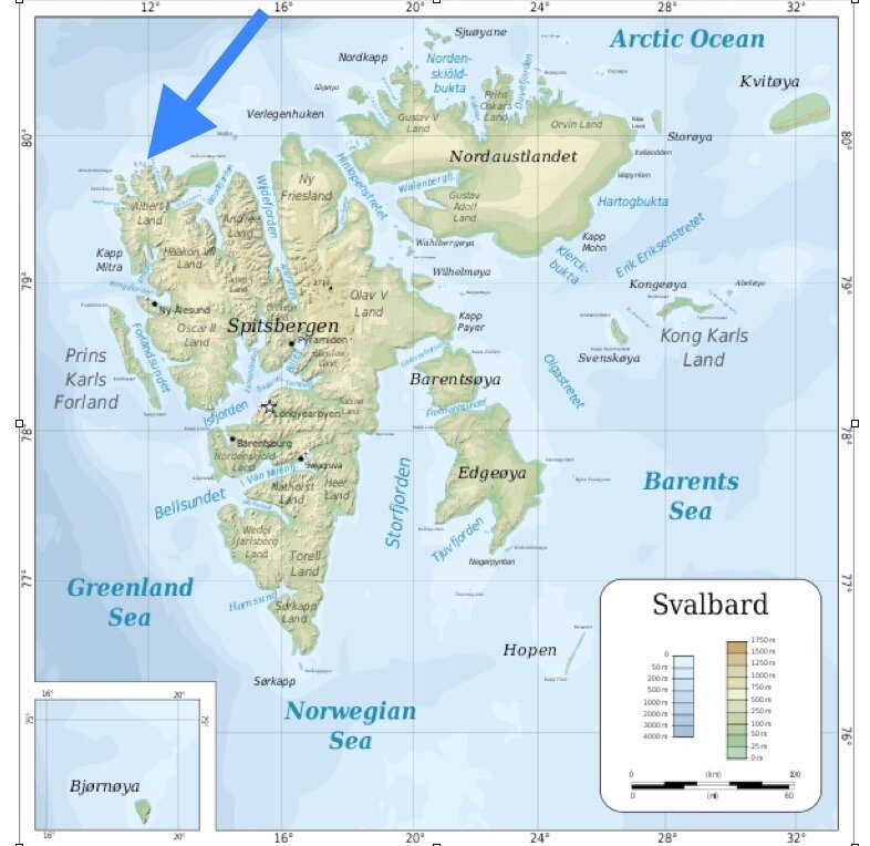
Ytre Norskøya’s location in relation to Svalbard.
It was one of the only landings where we couldn’t immediately see ice, but I was no less enthralled by the land. A gathering of islands poked out of the sea like giant knees in a bathtub, cloaked in monochrome gray-ness and snow. It was a stark contrast from the brilliant blinding blue sky and soothing teal ice from the previous day in Lilliehöökbreen.
We prepared for on an excursion on the island of Ytre Norskøya - the furthest northern point that we will see on this trip - almost to 80ºN (79.5º). The next thing to see when looking out from the island is the north pole. For some reason, it felt like I should be looking upward to see the north pole from that point, but we just looked out… over the water. It’s funny how looking up means looking outward from all points on this planet.
So, we looked out, towards the north, squinting through snow and wind.

Looking out to the north pole from the island of Ytre Norskøya.
Our morning excursion split into two groups once again. One stayed at the lower lookout point to the east (called 'de Kleine Uitkijck' – the small lookout), and I was with the group that headed up to the lookout point atop the mountain in the center of the island ('de Groote Uitkijck' — the big lookout). With the whole group, we made our way to the point on shore where we would await instructions and split into the two groups. We passed graves of whalers. In the summer, their sculls and bones can be seen. But, now until June they are blanketed with snow.
The island of Ytre Norskøya is a point that whalers used in the 1600s as a lookout. Part of a chain of islands called Fair Haven, the area enabled ships to set anchor but still be able to get the necessary wind to sail out to sea.
We all walked about 15 minutes to a central point where a path to the lower lookout and the upper lookout converged. I went with maybe 15-18 others up towards the top, and about five stayed with the lower. We started hiking up and met an obstacle within 10 minutes. Snow had fallen in a way where we couldn’t see the rocks below. It drifted out, cantilevered over an unknown drop. So, our guide Kristin went to explore around a lower peak to see if we could re-nagivate around it. We came down the path again and started out from where we’d left the rest of the group but headed out on a new trajectory.

Half-way up to the Ytre Norskøya upper whaling lookout looking south.
We started up the snowy incline again. Snow to our thighs as we trekked upwards. After 20 minutes more, we were all hot and removing layers of our clothing. I’d worn an extra wool sweater and was regretting it. Sweating. (Something that can be dangerous in low temperatures like these.) We took some small breaks peppered in with the unrelenting wind and pelting snow.
After maybe 45 minutes or so, one of the other artists started feeling light headed. We rested a few minutes but shortly headed upward again. Soon after we started hiking, she started feeling faint again as we reached a point probably 3/4 the way from the peak. Our guides were mindful to keep all of us safe in the extreme conditions, so we settled in to take a longer break. Some artists took photos, some sketched (harried, with very cold hands). Very quickly after we stopped, the wind picked up even more. More snow, almost hail. Any body heat we had generated on the way up was quickly lost.
I was very cold within 20 minutes, but soon we reversed course and headed back down towards the Antigua. The return was much easier than the way up. I felt light on my feet, bounding down between drifts of snow and jutting black rock. Our group made it back to the ship by 1pm for lunch of salad and pizza. Everyone was so hungry! I think most of us ate 5-6 pieces each.
After lunch, I talked to Annet, the ship’s 2nd mate. She came to our cabin ask something about our room’s two life jackets. I asked her about the dynamics of different groups that travel on the ship. She had never done a trip with The Arctic Circle, but she said that the group during the week, who had been tourists from all over the world, was really annoyed and grumpy. They wanted to get to the 80th parallel but were unable to get out of Isfjorden due to bad weather. Our group couldn’t be more opposite of that. Everyone gets along, there aren’t any cliques, no squabbles, no tension. Everyone helps each other and watches out for one another. I wish we had even more time together and more time to spend in this incredible place.

Stopping for a longer break on the way to the upper whaler’s lookout.
I won’t forget the moody weather of this day - the coldest we’ve seen so far. Very windy, pelting icy snow flying sideways. Although the conditions here were the most uncomfortable yet, this is how I imagined this place to feel. Inhospitable to humans. All of the islands that surrounded us to the south were cloaked in thick clouds, seemingly devoid of life. Beyond, out to sea, was nothing but the top of the world.
This activity is made possible, in part, by funds provided by the Metropolitan Regional Arts Council (MRAC) through a grant from The McKnight Foundation.